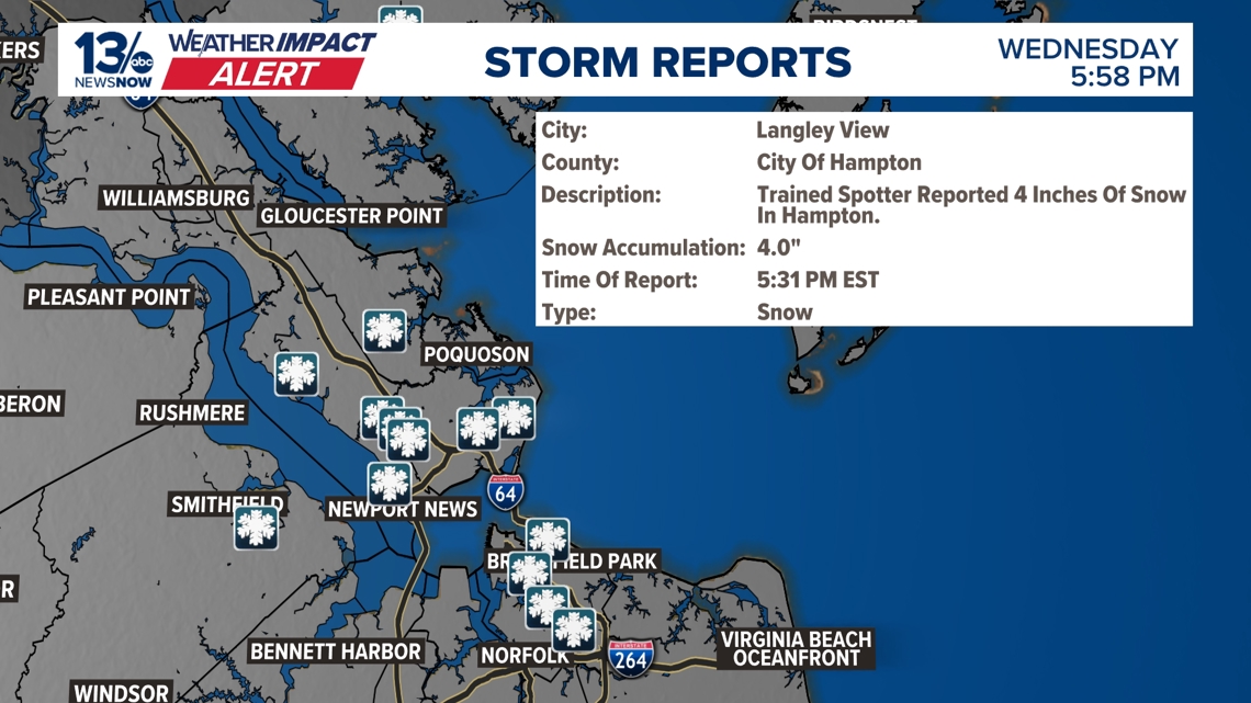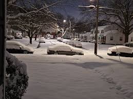
A winter storm of rare proportions swept through Norfolk and surrounding areas, leaving a stunning blanket of snow in its wake. With snow totals reaching over 10 inches in many places and some areas even surpassing a foot of accumulation, residents woke up to a winter wonderland unlike any seen in recent years. The meteorological event prompted a Weather Impact Alert for February 20 due to hazardous road conditions caused by the heavy snowfall.
The storm, which commenced around midday on Wednesday and persisted until the early hours of Thursday morning over a span of 16 hours, resulted in Norfolk registering the 8th highest single-day snowfall on record at 10.2 inches. The snowfall continued for a few more hours, culminating in a storm total of 10.6 inches, marking the 12th highest snow accumulation from a continuous event since records began in 1890.
As the storm moved offshore and atmospheric pressure shifted, windy conditions prevailed, with temperatures struggling to rise above freezing and gusty winds reaching speeds of up to 30 mph. The chill in the air made it feel like the upper teens to low 20s throughout the day, further exacerbating the wintry conditions. The frigid temperatures following the storm ensured that the snow remained on the ground well into Thursday night and possibly into Friday morning, with forecasts indicating a delay in temperatures rising above freezing until Friday afternoon at the earliest.
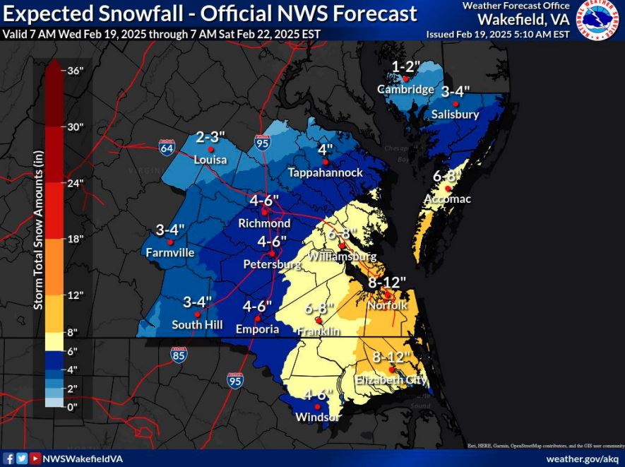
Northeastern North Carolina witnessed a mixture of sleet alongside the snow, resulting in reduced snowfall totals in that region. Meanwhile, the Williamsburg area braced itself for what could potentially be the most significant snowfall in eight years, with meteorologists predicting a substantial 6-8 inches of snow before the storm dissipates on Thursday morning. The anticipation of heavy snowfall led to the issuance of a winter storm warning for Hampton Roads, northeastern North Carolina, and parts of the Eastern Shore.
The impending storm, driven by a low-pressure system, was forecasted to originate from the south, with snowfall expected to commence between 8 and 10 a.m. Schools across the affected areas preemptively closed, with precautions set in place as the storm gathered momentum throughout the day. The relentless snowfall was projected to intensify later in the afternoon, promising rapid accumulation and treacherous road conditions. This recurring pattern of winter weather patterns can be attributed to drastic shifts in the polar vortex, ushering in waves of frigid air from the Arctic that cloak certain regions in relentless snowfall.
Emergency services, such as the Virginia Department of Transportation, mobilized pre-storm preparations, including the application of brine to roadways to deter snow and ice buildup. These proactive measures aimed to mitigate the impacts of the storm on transportation infrastructure, ensuring smoother operations and increased safety for commuters. Moreover, the VDOT stood ready with stockpiles of salt and sand to combat potential post-storm refreezing on road surfaces, emphasizing the importance of proactive measures in handling severe weather events effectively.
As residents across affected regions braced themselves for the winter storm's aftermath and the lingering chill in the air, the resilience of communities in the face of adverse weather conditions highlighted the importance of preparedness and proactive measures in mitigating the storm's impact. As the snow settled and temperatures remained frosty, the winter wonderland left behind by the storm painted a picturesque yet arduous landscape for residents and service providers alike.