As severe weather patterns continue to wreak havoc across the United States, millions of Americans find themselves bracing for a tumultuous and potentially dangerous week ahead. Forecasters are warning of a combination of extreme heat and thunderstorms that could pose serious risks to communities from the Midwest to the East Coast.
AccuWeather has issued alerts for multiple rounds of thunderstorms that are likely to bring the threat of flash flooding in the Midwest and East. These weather events are occurring on the periphery of a "heat dome," a high-pressure system that could usher in triple-digit temperatures in various states. As of July 20, more than 50 million Americans, stretching from Texas to Missouri, were already under extreme heat warnings or advisories.
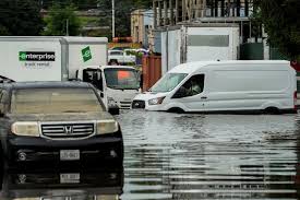
The severe weather threat is expected to persist, with thunderstorms bringing hail and powerful winds with gusts of up to 85 miles per hour. States including Illinois, Indiana, Ohio, Kentucky, and West Virginia are faced with the looming possibility of flash flooding and damaging winds.
AccuWeather Senior Meteorologist Alex Sosnowski emphasized the heightened risk of life-threatening flash flooding in several regions. The recent heavy thunderstorms have left the area saturated, making it more vulnerable to additional rainfall and flash floods.
Experts are closely monitoring a bulge in the jet stream that is contributing to the formation of a persistent heat dome, which may linger well into August. Areas such as Kansas City, Missouri, are predicted to see temperatures soaring above 100 degrees, marking an unusually prolonged and intense heat wave.
Meanwhile, in the aftermath of devastating floods in Kerr County, Texas, the number of missing individuals has been revised down from 97 to three. Through collaborative efforts among state and local agencies, many individuals initially reported as missing have been located and confirmed as safe, reflecting the community's resilience in the face of natural disasters.
As the weather remains unpredictable, another 50 million people residing from Kansas to the Carolinas are currently under heat alerts. Flash flood watches have been issued across the Midwest, heightening concerns about torrential rain and the potential for flash flooding in several regions.
In the Midwest, slow-moving thunderstorms are expected to bring heavy rainfall, increasing the risk of flash floods. Additionally, areas such as northeast Missouri and central Illinois are on high alert for dangerous flash flooding, with the possibility of multiple flash floods occurring.
Moreover, parts of the Dakotas, the Ohio River Valley, and the Northeastern United States, including New York City and New England, are bracing for severe thunderstorms that could bring damaging wind gusts, hail, and even tornadoes.
With heat index values soaring across the country, cities like Little Rock, St. Louis, and Nashville are forecasted to feel temperatures in excess of 100 degrees. The heat index is predicted to reach alarming levels in various cities in the Carolinas and Florida, signaling the expansion of the dangerous heat wave across the Midwest.
In the coming days, the impact of extreme heat is expected to intensify, prompting the issuance of extreme heat watches for parts of Kansas, Missouri, and Illinois. As the situation continues to evolve, vigilance and preparedness are imperative for individuals and communities in the path of these severe weather events.