As Thanksgiving approaches, Upstate New York is bracing itself for a significant lake effect snowstorm that is expected to impact travel plans and create challenging weather conditions for many areas. The National Weather Service has issued winter storm watches for 15 Upstate counties, covering a vast region from Wednesday night through Saturday. Areas near the eastern shores of Lake Erie, particularly southwest of Buffalo and the Tug Hill Plateau, are likely to experience a foot or more of snow on Thursday and Friday.
Central New York and the Southern Tier are also expected to see snowfall, albeit in lesser amounts compared to the western regions. Friday is poised to be the day with the most snow for these areas. Alongside the heavy snowfall, wind gusts up to 40 mph are predicted for Thursday and Friday, further exacerbating conditions by reducing visibility and causing snow drifts. Temperatures are anticipated to plunge into the 20s, with wind chills dipping into the teens.
The weather scenario is expected to unfold dynamically, with Wednesday possibly starting out rainy before a cold front ushers in a transition to snow, especially at higher elevations. Heavy lake effect snow is projected to kick off Wednesday night in Western New York and early Thursday on Tug Hill before gradually shifting westward later on Thursday. This westward shift will direct the snow towards Central New York, the Mohawk Valley, and the Finger Lakes region.
For Syracuse, snowfall estimates range from 3 to 8 inches starting late Thursday and continuing into Saturday. The duration of this event is anticipated to be prolonged, with variations in wind direction off the lakes contributing to the snowfall fluctuations, as indicated by the weather service.
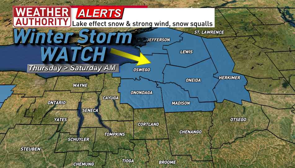
As the winter storm watch extends to encompass Onondaga, Madison, Oneida, Herkimer, Oswego, Lewis, and Jefferson counties from Thursday through Saturday morning, residents in these areas are advised to prepare for challenging weather conditions. Road conditions are expected to be mainly wet initially, with the situation worsening on Friday, particularly in Central New York. Travelers should anticipate snow-covered roads and difficult driving conditions in the region, particularly with high winds and the possibility of heavy lake effect snow.
The struggle against the elements continues with the forecast for milder conditions on Tuesday gradually transitioning into an increasingly challenging weather pattern from Wednesday onwards. With a big warmup expected on Wednesday before a swift cold front ushers in a sharp change, the stage is set for a significant snow event that could impact holiday travel plans on Thursday and Friday. The southern tier, in particular, is expected to bear the brunt of the snow, with substantial accumulations likely.
Before the lake effect snow descends, Western New York will grapple with milder temperatures and light rain across the region, paving the way for the impending snowy conditions. Strong winds are also set to accompany the winter blast, potentially affecting outdoor decorations and creating hazardous conditions.
As the region prepares for the impending snowfall, advisories and warnings have been issued for various counties, highlighting the potential impacts of the approaching winter storm. Lake effect snow warnings, winter weather advisories, and wind advisories are in effect for different regions, emphasizing the need for precautions and preparedness to ensure safety during holiday travel.
In conclusion, Upstate New York is on high alert as it braces for a significant lake effect snowstorm that is expected to impact travel plans and create challenging weather conditions across the region. With heavy snowfall, strong winds, and plummeting temperatures in the forecast, residents are urged to stay informed, take necessary precautions, and exercise caution while navigating the wintry conditions in the days ahead.
