Boston Weather Update: A Wintry Mix on the Horizon
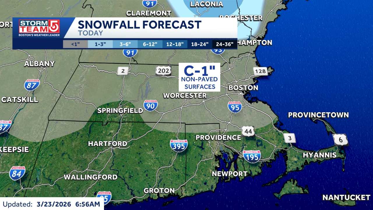
As the Boston area braces for a significant shift in weather, residents are preparing for a mix of rain and snow that could lead to an inch of accumulation. This unusual late-March snowfall marks the first time in eight years that Boston may experience measurable snow after the spring equinox.
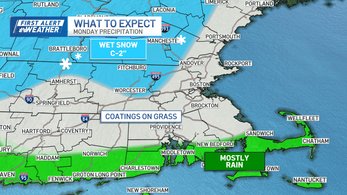
A potent frontal system is currently sweeping through New England, bringing a variety of weather conditions. On Monday morning, the rain-snow line is expected to dip further south, leading to snow showers across Greater Boston and into western Massachusetts. While areas closer to the coast may experience a lighter wintry mix, those further inland could see more substantial snow.
The forecast indicates that most of the snowfall will occur during the predawn hours, with totals likely reaching around an inch for the Boston area. Northern Worcester and Berkshire counties could receive even more, with estimates ranging from one to two inches. However, the most significant snow accumulation is predicted to remain in the northern reaches of New England.
As commuters head out on Monday, they should anticipate wet roads and potentially slick conditions due to the combination of rain and snow. The morning commute could be particularly challenging, as snow and sleet create messy travel conditions. Meteorologists are advising caution, especially in areas where the transition from rain to snow is occurring.
Throughout the day, scattered snow showers are expected to linger, keeping conditions unsettled under mostly cloudy skies. Wind gusts of around 20 mph will add an extra chill to the air, although they are not expected to cause power outages. The storm system will gradually pull away from the region, but not before leaving its mark on the local weather.
As the week progresses, it will be interesting to see how this late-season storm impacts the region. With public interest in the weather trending, many are eager to see how this wintry mix unfolds across Massachusetts.