As winter weather continues to unfold across the Carolinas, residents are bracing for the impact of scattered snow and freezing rain. While not anticipated to be a significant winter storm, this weather system will still affect travel conditions, particularly on Wednesday evening into Thursday morning. The forecast suggests a mix of precipitation types, with freezing rain and sleet expected in the Charlotte metro area, transitioning to snow towards I-40. By Wednesday afternoon and evening, scattered snow showers will be prevalent throughout the region.
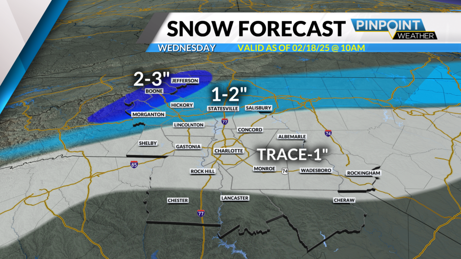
In terms of snowfall accumulation, the Charlotte metro is predicted to receive minimal amounts, with roughly a trace to an inch of snow, while areas along I-40 may see slightly higher totals of around 1-2 inches. The mountains could experience 2-3 inches of snow, with isolated areas possibly receiving higher amounts. Additionally, there is a possibility of a few flurries persisting into Wednesday night and Thursday morning, potentially leading to additional coatings of snow in certain areas.
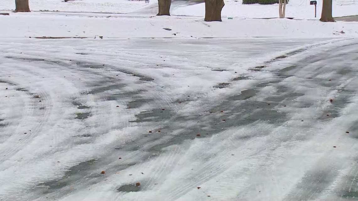
Ice accumulations are expected to be relatively light in the Charlotte area, with a glaze to a tenth of an inch of ice forecasted. Although light, any ice formation could still pose risks on roadways; however, the likelihood of downed trees and power outages remains low. While slick spots may be present throughout Wednesday, the most significant travel impacts are expected Wednesday evening into Thursday morning as daylight dwindles, leading to decreased surface temperatures.
As Thursday progresses, dry conditions and ample sunshine are expected to prevail, though temperatures will remain cold, ranging from the mid to upper 30s. Over the weekend, a gradual warming trend is likely to occur, accompanied by continued dry weather conditions, offering a respite from the wintry mix experienced earlier in the week.
The Triad region in North Carolina is also anticipated to encounter scattered snowfall on February 18, with snow moving in during the morning hours and tapering off by the evening. The inclement weather may result in slick road conditions, prompting residents to exercise caution while traveling. WFMY News 2 will provide live updates and weather information through their dedicated blog and app to keep the community informed and prepared for any developments.
In a separate weather advisory for Myrtle Beach, South Carolina, a FIRST ALERT WEATHER DAY has been issued due to anticipated freezing rain in inland areas. The advisory spans from Wednesday afternoon to Thursday morning, cautioning residents about potentially hazardous travel conditions. The impacted regions include Horry County, Georgetown County, and several others, with a risk of light freezing leading to challenging commuting situations during the Wednesday evening and Thursday morning rush hours.
An approaching low-pressure system coupled with cold air inflow is expected to bring cloudy and cold weather to the area, with temperatures hovering in the upper 30s and lower 40s for inland regions. Rain showers are projected to transition into freezing rain and sleet by the afternoon and evening hours, particularly across the Pee Dee region, near the North Carolina border. The threat of freezing rain accumulation, reaching up to a quarter of an inch, raises concerns about icy road conditions and potential power outages, mainly in areas under the winter weather advisory.
In Horry and Georgetown Counties, which are closer to the Grand Strand, a cold rain is anticipated, potentially turning into light freezing rain or drizzle as temperatures drop. While the likelihood of significant ice accumulations is low along the coast, precautions are advised for any icy patches that may develop on bridges and overpasses. Post-system, cold and blustery conditions are expected, with a chance of isolated flurries and temperatures struggling to reach the upper 30s.
As residents across the Carolinas adjust to the fluctuating weather patterns, adherence to safety guidelines and weather alerts remains paramount to mitigate any potential risks and ensure preparedness for varying conditions. Stay informed through local news sources and weather apps to stay ahead of changing conditions and make informed decisions during winter weather occurrences.