Severe weather alert: North Texas in the path of powerful storms
North Texas finds itself in the grip of severe weather this Saturday as storms sweep through the region, unleashing high winds and hail up to the size of a quarter. Areas such as Fort Worth, Burleson, Crowley, Rendon, and Cross Timber are particularly affected, along with locations like Briaroaks, Lillian, and Egan. Commuters on I-35 between mile markers 28 and 42 should exercise caution as the storm progresses.
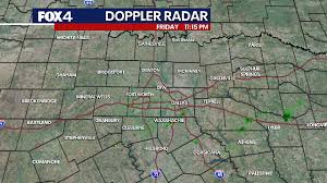
Meteorologists are closely monitoring the situation, with FOX 4's Ali Turiano providing regular updates on the fast-moving weather patterns. The inclement weather is part of a larger system associated with a cold front marching towards North Texas, bringing a heightened risk of severe thunderstorms, particularly in the eastern reaches of the Dallas-Fort Worth Metroplex.
Initially projected as a weaker system, meteorologists have revised their forecasts to include a broader coverage of rain and thunderstorms, issuing a "marginal risk" warning for most of North Texas and a "slight risk" alert for eastern zones. Damaging winds reaching up to 60 mph and hail up to half-dollar size are the main concerns, with a relatively low tornado threat confined to a specific region.
Safety remains a top priority as this storm system is the first significant weather event after a prolonged period of calm. Residents are advised to stay vigilant, watch for updates from local authorities, and ensure they have the necessary weather alert apps downloaded to stay informed and prepared.
The storm's timeline indicates that the most intense weather activity is expected between noon and 6 p.m., with the eastern and southeastern zones possibly experiencing stronger impacts due to warmer temperatures conducive to atmospheric instability. By late afternoon, the threat is expected to diminish, paving the way for cooler temperatures as northerly winds usher in a significant cooldown.
Looking ahead, Sunday promises clear skies and pleasant weather conditions, marking a respite from the recent turbulent storms. Monday is expected to bring warmer temperatures before another cold front approaches, introducing the possibility of additional rain and moderating temperatures for the coming week.
Meanwhile, in Lubbock, Texas, a separate weather system is brewing. Gusty winds, cooler temperatures, and bouts of showers are on the weekend forecast. Rain chances are set to arrive late Friday night and exit by midday Saturday, with northwest winds and cooler temperatures persisting into Sunday. Residents are advised to prepare for the dip in temperatures, especially in the north and northwest regions where overnight lows could hover around the 30s.
In Houston, a different weather scenario is unfolding, with the potential for severe storms in northern areas. The cold front is expected to move southeast, bringing the risk of strong storms with damaging winds. As the front progresses, cooler temperatures and drier conditions are anticipated, heightening the fire danger in the area.
The upcoming days are forecasted to witness a series of cold fronts shaping the weather patterns, ultimately leading to a drop in temperatures and fluctuating conditions for Texans across various regions. Stay tuned for further updates and heed local advisories for a safe and informed weather experience.
As the weather situation evolves, it's essential for residents to stay informed through reliable sources like local meteorologists and official weather channels. By remaining vigilant, prepared, and adaptable, communities can navigate through these weather challenges with resilience and safety. Stay safe and stay weather aware!