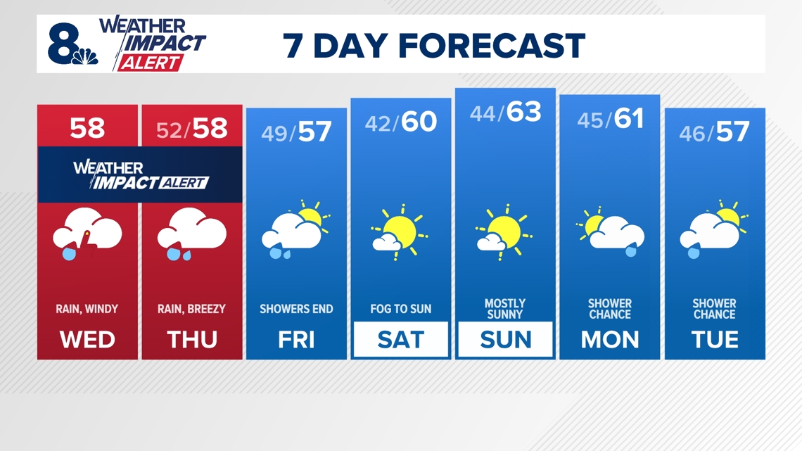
The wet start to November in the Portland metro area has caught the attention of local meteorologists. Both KGW and KATU have issued Weather Impact Alert and Storm Tracker 2 Weather Alert days, respectively, due to heavy rain and gusty winds expected in the region. As per KGW, the Weather Impact Alert will expire at 7 p.m., with the heaviest downpours predicted along with possible thunder and gusty south winds of 30-40 mph in the Willamette Valley, especially throughout Wednesday until the evening hours.
Meteorologist Matt Zaffino of KGW has reassured that the wind and rain on Thursday are not expected to be as extreme, with only brief gusts of 23-30 mph anticipated in the afternoon. Despite the lesser impact on Thursday, wet roads and intermittent gusty winds pose potential risks for drivers, urging them to exercise caution, slow down, and plan for longer travel times.
The primary objective behind the implementation of KGW Weather Impact Alerts is to provide the community with accurate and timely weather information to ensure safety for individuals and families. By receiving alerts well in advance, residents can stay informed and prepared for any weather-related challenges that may arise.
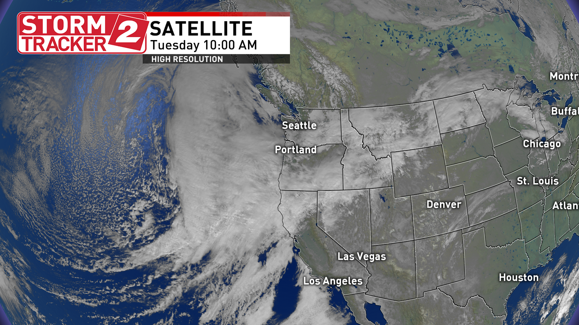
Meanwhile, KATU has declared a Storm Tracker 2 Weather Alert due to the possibility of severe weather on Wednesday. An atmospheric river is expected to bring rain to the Portland area, with heavy rain and gusty winds anticipated overnight as a cold front sweeps through the region. Gusty winds could lead to downed trees and power disruptions in coastal and Willamette Valley regions.
Meteorologist Rhonda Shelby of Storm Tracker 2 emphasizes the potential for messy conditions should the core of moisture in the atmospheric river linger over the area, leading to saturated commutes, fallen branches, and coastal flooding due to King Tides. Rainfall amounts are projected to exceed two inches in coastal and Cascade regions by Friday, while the Willamette Valley may receive one to two inches of rainfall.
Moreover, while social media discussions hint at a tornado possibility, Shelby advises caution, citing low probabilities. The Storm Prediction Center highlights a minor chance of low-topped thunderstorms capable of producing waterspouts or brief tornadoes. However, the likelihood of encountering significant hail or severe wind gusts remains slim.
Looking ahead, another cold front is expected on Thursday, posing fewer impacts on the region. For those seeking real-time weather updates and alerts, downloading the Storm Tracker 2 Weather App is recommended to have instant access to watches and warnings.
This detailed weather update underlines the importance of staying informed and prepared as Portland experiences inclement weather conditions. Both KGW and KATU are committed to ensuring public safety by providing accurate forecasts and alerting residents to potential weather hazards. Stay tuned for further updates as the weather situation evolves in the coming days.